What is a Watershed?
An area of land that drains or “sheds” water into a specific waterbody. Every body of water has a watershed.
Watersheds drain rainfall into streams and rivers. These smaller bodies of water flow into larger ones, including oceans. Gravity helps to guide the path that water takes across the landscape.
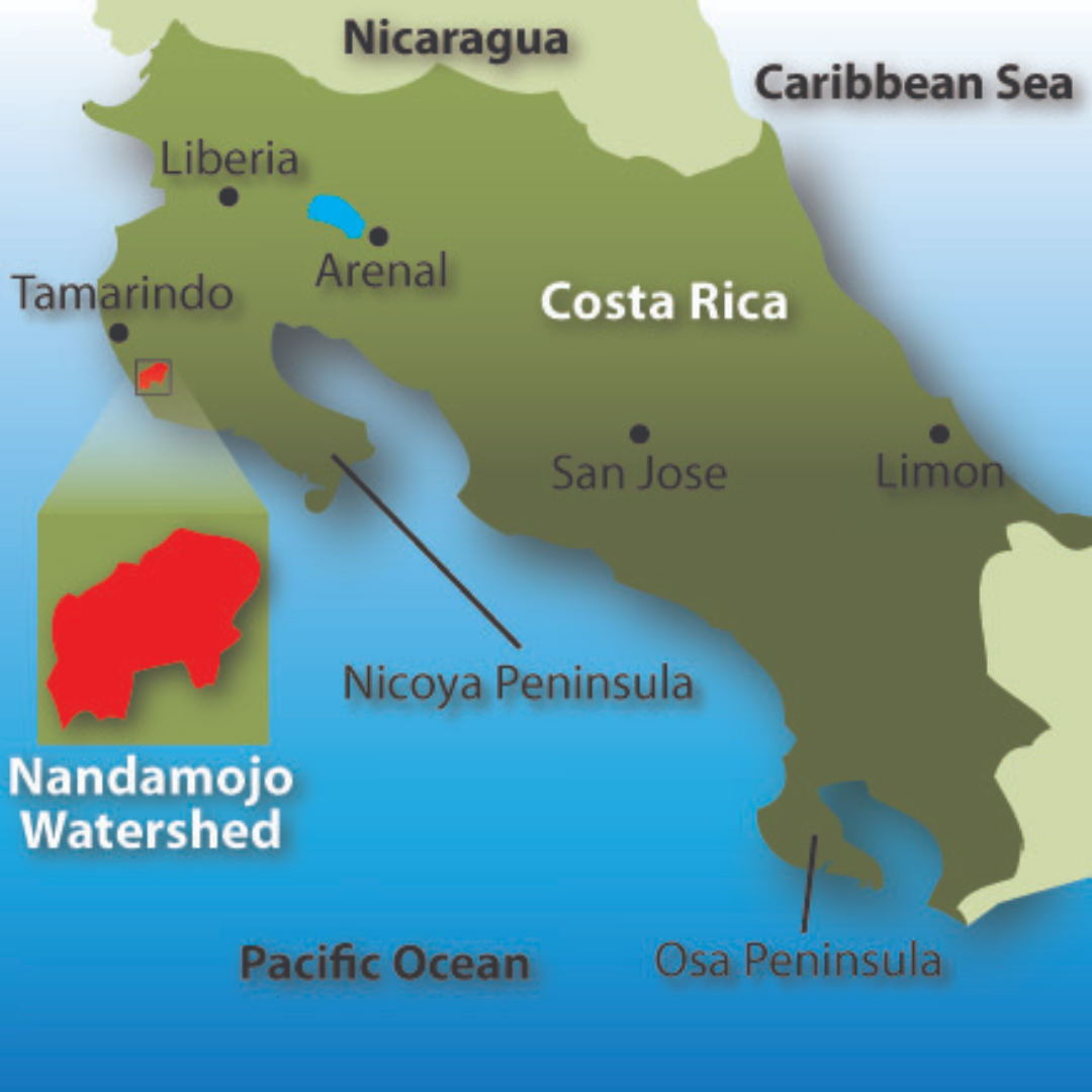
The Nandamojo Watershed
is located on Costa Rica’s northwest coast in the province of Guanacaste. The watershed encompasses 29,000 acres, from the community of 27 de Abril to Playa Junquillal, where the river empties into the sea.
Challenges and Opportunites
In Guanacaste...
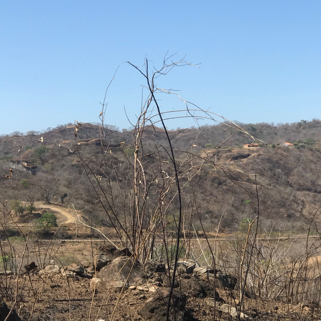
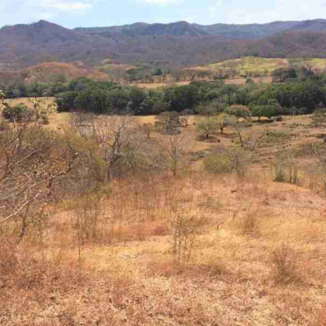
Dry Season
The Costa Rica "winter", which starts in November, is caused by trade winds that blow in from the Caribbean. As this air moves west across the country it loses moisture, reaching Guanacaste as a gusty dry wind that desicrates the landscape.
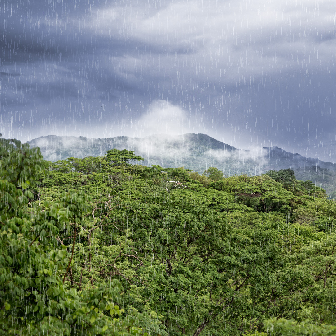
Wet Season
In May, the trade winds shift and allow offshore weather from the Pacific to bring afternoon showers and humidity. For the next six months, rivers and lowlands areas are filled with water and the landscape is a jungle of green.
This “tropical dry forest” supports a unique ecosystem of flora and fauna.
Before the Beef Boom...
Guanacaste was sparsely settled until the 1900s, and the agricultural communities in the Nandamojo River Valley were largely isolated from the rest of the country. Fertile lowlands, ample drinking water in the dry season and nearby forests teeming with wildlife sustained a self-sufficient rural population that actually exported grains, livestock and timber to the country’s metropolitan areas.
1950-1960
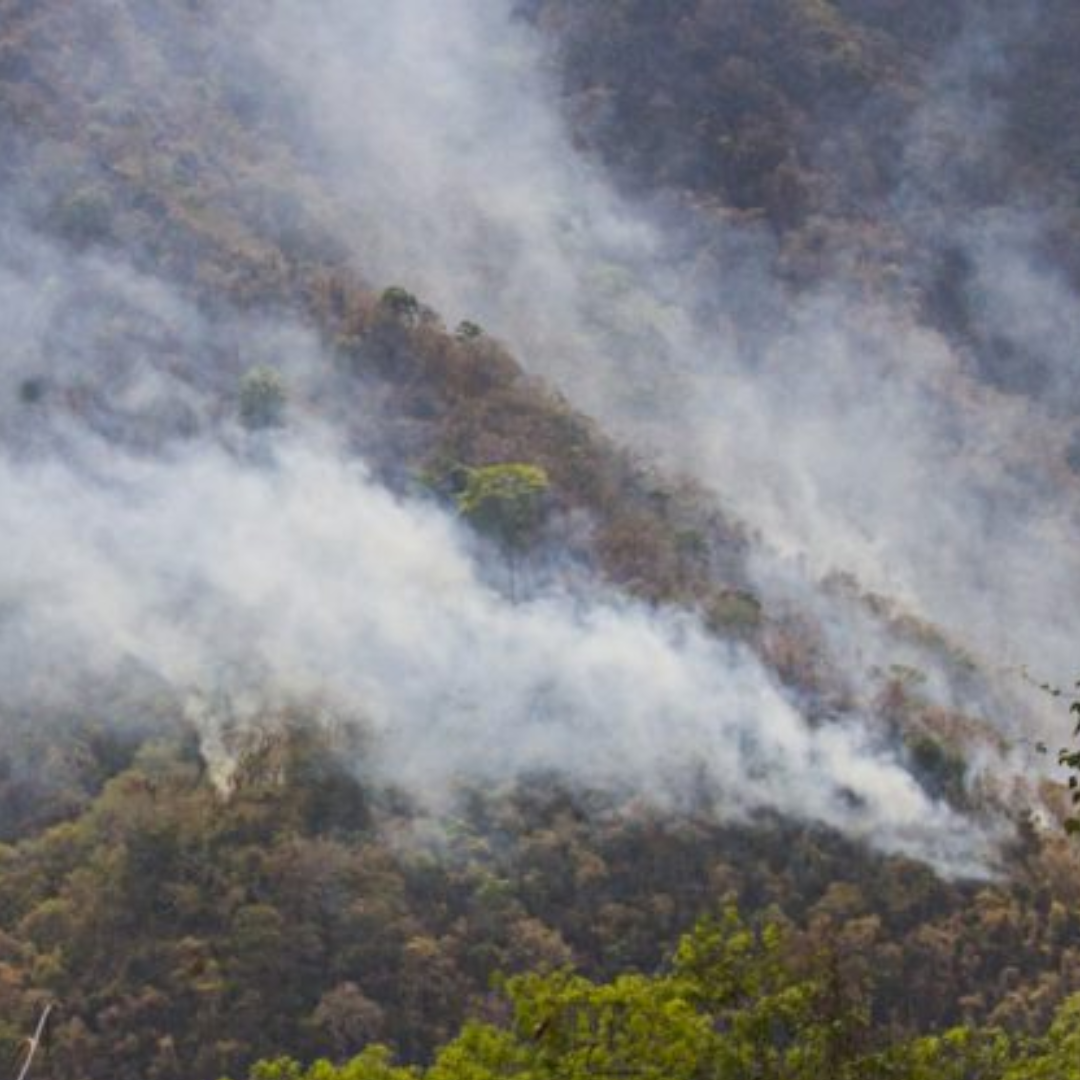
US demand for cheap hamburger provided an irresistible economic opportunity for the region. Much of the land in Guanacaste was cleared by fire to create grazing land for millions of beef cattle.
Without trees and native grasses...
to protect it from wind and rain, the land eroded quickly. Fertile valleys were carpeted with a non-permeable layer of fine silt. Swamps and estuaries filled with debris and could no longer absorb seasonal fluctuations in rainfall...
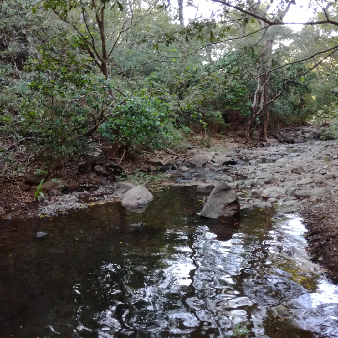
The water table fell.
As the seasons between the rains grew longer and hotter, many rivers, including the Nandamojo, began to dry up for part of the year.

1970's...
Development Pressure dramatically altered the region’s ecology, economy and social fabric. Most food is now imported from other parts of the country or from overseas. Land-based traditions are fast disappearing and a wealth of indigenous technical knowledge has been neglected.
Elders in the region still remember...
when the Rio Nandamojo flowed year-round. When the valley was fertile and the forests teemed with birds and other wildlife. When food was produced locally and people could earn a livelihood in their own community.
Restoring that memory is a guiding vision for our work in the watershed.
The Nandamojo Valley
Our vision is to restore the Nandamojo as a healthy and resilient ecosystem functioning in balance with human communities and economies
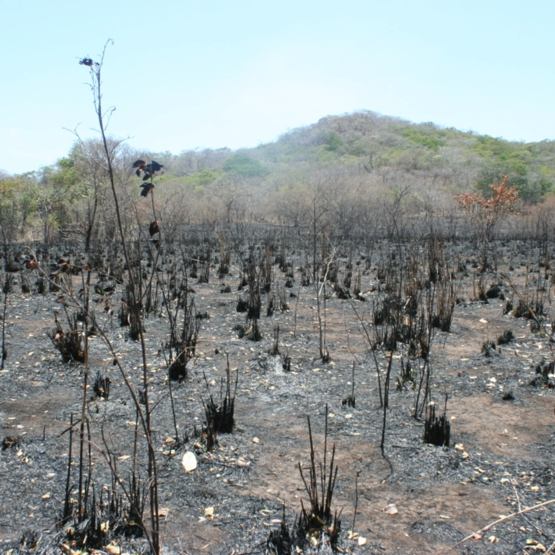
Most Nandamojo landowners use simple strategies to maintain their farms, employing herbicides or fire to clear and maintain spaces for cattle or subsistence agriculture. Little thought is given to the protection of water resources.
Why?
First, agricultural outreach programs that have trained most of Guanacaste’s farmers put little or no importance on doing so. Second, the stagnant local economy has left most landowners struggling to
make ends meet and unable to invest in new strategies for land use.
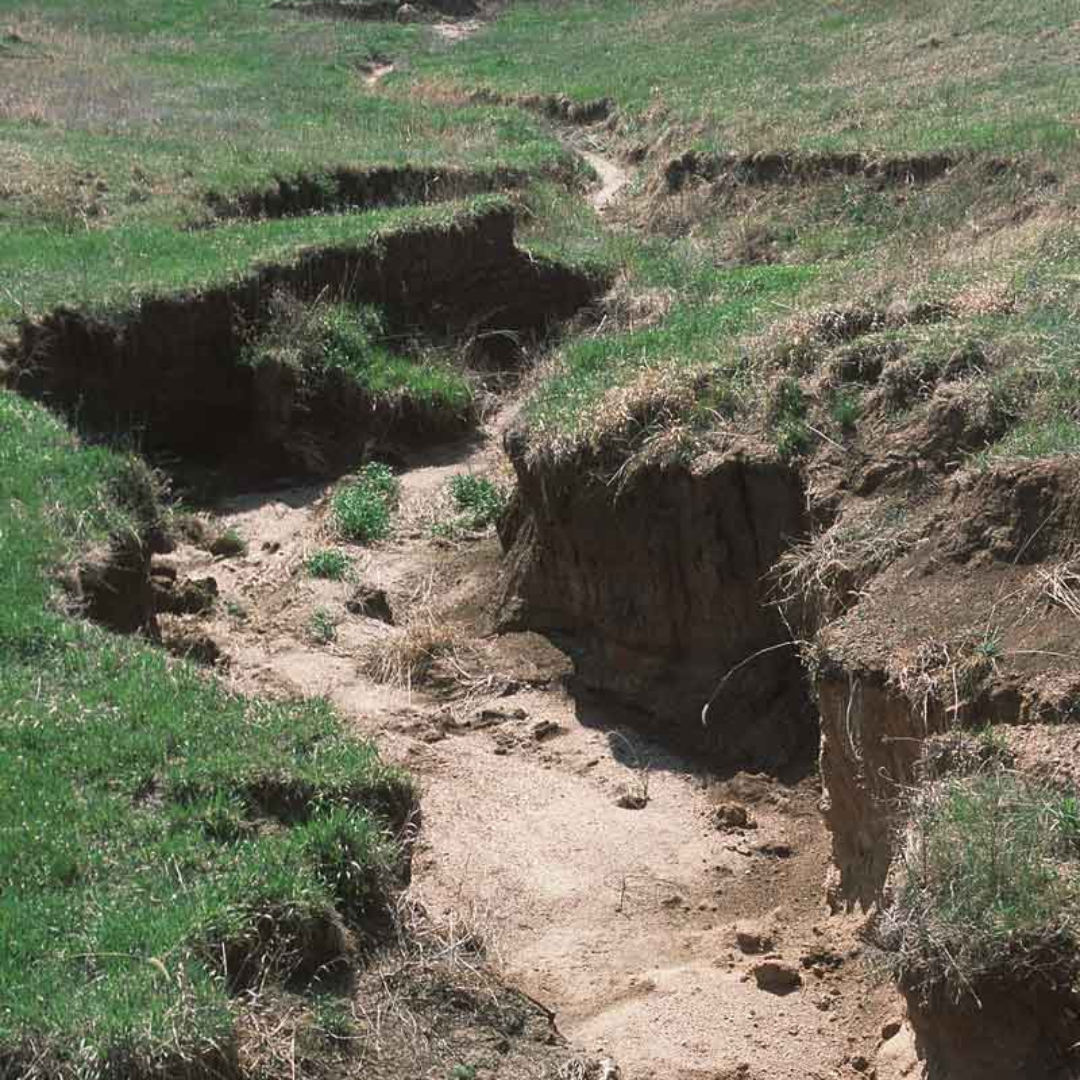
The situation poses a grave threat to the future of the Nandamojo and its residents. Cleared land absorbs less water than forests, so a larger percentage of rain on cleared areas becomes surface runoff instead of infiltrating the ground to recharge aquifers. The runoff is “lost” instead of “harvested,” and can further damage an ecosystem by carrying away topsoil through erosion.
ROW is working with Nandamojo farmers to change the way they use their land, to harvest more rainwater and prevent erosion.
Some Nandamojo communities are already reporting groundwater shortages during Guanacaste’s dry season, which is a six-month period of absolute drought.
Climate change models predict that this area of Costa Rica will receive even less rain in future decades.
ROW Partner Organizations
We are grateful to work with supportive groups and organizations that are helping us achieve our goals to education, inspire and change the inhabitants of the Guanacaste Region.
Collapsible content
NANDAMOJO VALLEY CHAMBER OF COMMERCE
ROW founded and incubated the Chamber of Commerce as a way to unite the local business community around our vision for a sustainable future. In addition to the towns and villages within the watershed, the chamber’s area of influence includes the adjacent communities of Playa Callejones, Los Pargos/Playa Negra and Playa Avellanas. The chamber has grown to include 45 local businesses and community organizations.
COMITÉPRO-BANDERA AZUL ECOLÓGICA DE LA CUENCA DEL RÍO NANDAMOJO (Watershed EcologicalBlue Flag Committee):
The Ecological Blue Flag program is a national initiative aimed at providing incentives for the protection of water resources. ROW organized the Nandamojo’s first watershed-level Blue Flag committee, which has been awarded this distinction for the past three years. In 2014, the Nandamojo was one of just 26 watershed in Costa Rica to be awarded this prize.
ASOCIACIÓNde CONSERVACION VIDA VERDIAZUL – AVIVE
Project started with funding by World Wildlife Fund, works to monitor and protect marine turtles, especially the leatherback that is in danger of extinction. Now an independent non-profit organization,
this group performs important outreach activities and also does environmental education within local communities.
ASOCIACIÓN SALVEMONOS- (SAVE THE MONKEYS)
Organization dedicated to reforestation, biological corridors and “monkey bridges” over
streets and highways in order to better harmonize development with the local populations of Howler monkeys.
AMIGOSDEL DIRIÁ
A group of concerned stakeholders from Santa Cruz are organizing themselves to protect the Diriá National park, which encompasses 5,400 hectares (13,350 acres) of primary and secondary dry tropical forest near the city.
TIERRA PACIFICA and PUEBLO VERDE ECOLOGICAL COMMUNITIES
These two sustainable developments, located within the Nandamojo, serve as proving
grounds for the strategies that ROW promotes among watershed landowners.
CEPIA
A non-profit organization focused on children and youth at social risk. Together we work on environmental projects that help children from Cepia programs and tree donation campaigns.